Namibia
May 13th 2013: Kgalagadi Transfrontier Park, South Africa – Mesosaurus Fossil Camp, Namibia
Driven distance on May 13th 2013: 240km (150 miles)
Driven distance total: 61’930km (38’480 miles)
We were happy to be driving in Namibia after the terrible roads in the Kgalagadi Transfrontier National Park. The unpaved roads in Namibia seemed to be quite good and it’s no problem to cruise around with 80km/h (50 mph). It felt like a roller coaster to drive the completely straight road through the Kalahari Desert. From one dune to the next, it always went up and down.
We spent our first night in a so called bush camp. Completely out in the nature were some really simple toilets and showers and the only sound we heard was the whistling from the birds:-).
May 14th 2013: Mesosaurus Fossil Camp – Quiver tree Forest Camp, Namibia
Driven distance on May 14th 2013: 70km (40 miles)
Driven distance total: 62’000km (38’520 miles)
Unfortunately you can enter the area with the fossils of the Mesosaurus only together with a guide. Du to cost savings reason we skipped the tour and went instead to the little museum to see some ancient bird nests and wood which was now like stone after the millions of years. There were also some impressive fossils of the Mesosaurus, which lived in this area about 270 million years ago on display.
We continued then to the Quiver tree Forest Camp, where we enjoyed a relaxing afternoon. There were also four cheetahs living near the campground area. Every day at 4PM they are being fed, so we also didn’t wanted to miss this spectacle. We were actually a bit surprised that we could enter the cage and watch the predators from close distance how they eat. At another cage were 2 other Cheetahs waiting for their food. We observed the 2 animals and quite surprised when we heard them meowing like tiny kitty cats :-).
May 15th 2013: Quivertree Forest Camp, Namibia
Driven distance on May 15th 2013: 10km (10 miles)
Driven distance total: 62’010km (38’530 miles)
Just 5km (3 miles) away from our camp was the so-called Giants Playground :-). Many rocks were built on top of each other like playing bricks, which were eroded from the nature over thousands of years. We went back to the campground after an impressive one hour hike in the “playground”. Shortly before sunset we visited the „Quiver Tree Forest“ just besides the campground. In this part of the world are quite many of those trees. In early times the indigenous people used the small stems of the trees as a holding device for the arrows.


May 16th 2013: Quivertree Forest Camp – Brukkaros Volcano Camp, Namibia
Driven distance on May 16th 2013: 150km (90 miles)
Driven distance total: 62’160km (38’620 miles)
We continued north after a quick shopping stop in the city Ketmanshoop. A long part of it ran on a highway, which was running on an endless seemingly plain. Already from far away we were able to spot the volcano. The road which led to the upper camp was that bad, that we would have been almost faster on foot. :-).
May 17th 2013: Brukkaros Camp, Namibia
Driven distance on May 17th 2013: 0km (0 miles)
Driven distance total: 62’160km (38’620 miles)
So we started our hike to the crater of the volcano. We could only imagine from the shape of the mountain that it used to be a volcano, since it didn’t erupt for a very long time. Special were once again the quiver trees as well as the view to the surrounding area, which was completely flat.
Unfortunately we missed a really hidden sideway of the trail and ended up instead of the rim inside of the crater itself. Of course we didn’t give up and crawled around the volcano until we came somehow back on track. Back on the campground was the wind that strong, that we had to flee into one of the “chalets”. The wind was still a bit present on the inside, since the chalet on this ghost campground didn’t have a roof nor a door.
May 18th 2013: Brukkaros Camp – Ketmanshoop, Namibia
Driven distance on May 18th 2013: 110km (70 miles)
Driven distance total: 62’270km (38’690 miles)
The wind was also during the night very strong and we could almost not sleep due to the shuddering tent walls. Really sleepy we went in the morning back to Ketmanshoop to do some shopping and check the Internet. Because they told us, that on the next day the entire town doesn’t have electricity we had to finish all the Internet work in one evening. After the work was finished we enjoyed in a restaurant a yummy gemsbok steak :-).
May 19th 2013: Ketmanshoop – Cañon Road House Camping, Namibia
Driven distance on May 19th 2013: 170km (110 miles)
Driven distance total: 62’440km (38’800 miles)
This day led us on unpaved roads along fantastic rocky stepped landscapes. We stayed just a few kilometers before the Fish River Canyon on the Cañon Roadhouse Campground. The place was everywhere decorated with old relicts from traffic and road, so that we felt almost like in a museum.


May 20th 2013: Cañon Road House Camping – Ai-Ais Hot Springs Camping, Namibia
Driven distance on May 20th 2013: 130km (80 miles)
Driven distance total: 62’570km (38’880 miles)
After a short drive we arrived at the main view point of the Fish River Canyon. The view into the deep huge canyon is really spectacular. With a length of 161km (100 miles), a width of up to 27km (17 miles) and a depth of 550m (1800 feet) it is the second largest in its kind in the world, after the Grand Canyon in Arizona. Along the canyon we could enjoy other very impressive views from different points.
May 21st 2013: Ai-Ais Hot Springs Camping – Amanzi Trails River Camp, Namibia
Driven distance on May 21st 2013: 150km (90 miles)
Driven distance total: 62’720km (38’970 miles)
Todays plan contained a short trip back to South Africa because we needed to go to customs. Some time back in South Africa we purchased quite a few things (fridge, car repairs, roof rack, etc…) and had to pay of course the 14% tax. Since at the border post Mata-Mata, where we crossed into Namibia, is only immigration and no customs, we started the project to get the 14% tax back at another crossing. Without any problems we could move back and forth, but things didn’t work out exactly as we planned it. It doesn’t seem to be that easy as on airports. We did get all our receipts stamped but didn’t receive any money. Let’s see if it will work out somehow later.
Somewhat later we camped at a really nice campground directly at the Orange-River. The view onto the river as well as the impressive rock formations behind it was very picturesque during the red sunset.


May 22nd 2013: Amanzi Trails River Camp – Orange River (near Rosh Pinah), Namibia
Driven distance on May 22nd 2013: 130km (80 miles)
Driven distance total: 62’850km (39’050 miles)
The road led us along imposing mountain terrain along the well vegetated Orange-River, which draws the borderline to South Africa. Since the area was very nice and sparsely populated we enjoyed once again to camp in the wild. Directly at the river was a cozy place and we enjoyed it very much to camp without the luxury of electricity, shower, toilet and neighbors :-).
May 23rd 2013: Orange River (near Rosh Pinah) – Lüderitz, Namibia
Driven distance on May 23rd 2013: 340km (210 miles)
Driven distance total: 63’190km (39’260 miles)
We originally didn’t plan to visit Lüderitz since it is basically a dead end road and we have to drive back the same 120km (75 miles) long road. But since there is often a lack of ATM’s, supermarkets etc… in the sparsely populated Namibia and since we didn’t have any cash, fresh food or clean cloths we decided anyways to visit the touristy place. Luckily the road was tarred and we arrived it just before sunset. At the communal campsite we tried to hide from the wind. The weather in Lüderitz is famous for the wind and fog.
May 24th – 25th 2013: Lüderitz, Namibia
Driven distance on May 24th – 25th 2013: 80km (50 miles)
Driven distance total: 63’270km (39’310 miles)
In the town center of Lüderitz are still some buildings from the German colonial time. Many of the buildings, like the famous well sustained Goerke House, are around 100 years old. Some other buildings, like the reading hall, concert hall or the theatre we went to look at them from the outside. Quite many of them are still being used today. Towards the evening we drove to the nearby „Diaz Point“, where the first European, the Portuguese explorer Bartolomeu Diaz, landed in the year 1487. We stayed overnight at the campground there. Luckily there were some stone huts who gave us some shelter against the constant wind. The next morning the thick fog was back and the breakfast was everything else then enjoyable... We spent the day with exploring the Lüderitz Peninsula, where we could see Flamingos und Penguins as well as many small rocky coves.
May 26th 2013: Lüderitz – Klein Aus Vista Camping, Namibia
Driven distance on May 26th 2013: 180km (110 miles)
Driven distance total: 63’450km (39’430 miles)
One of the main attraction in Lüderitz is the ghost town Kolmanskop. Precisely at 10AM the guided tour took off, which was by the way also in German. People discovered diamonds here about 100 years ago and the settlement Kolmanskop began to exist because of the diamond boom. Despite the fact that the living conditions were very harsh, it counted a population of 400 and many nice German looking stone buildings were created. Besides the workers quarters and some official buildings were also a gym, theatre, school, hospital, etc… being built. Approximately 50 years later the town got left alone and since then it gets eaten step by step by the desert. A few of the houses got renovated but most of them are today partially covered with sand. Still today they are searching for diamonds in the National Park “Sperrgebiet” just besides it. This Park is a 100km (60 miles) long coastal stretch towards the South.
On our way to the village Aus we could see some of the wild horses in this region. Nobody knows exactly where they are coming from, but one realistic theory is, that German soldiers left them here during First World War. Finally after it was already dark, we arrived at the comfy campground „Klein Aus Vista“.
May 27th 2013: Klein Aus Vista Camping – Namtib Lodge, Namibia
Driven distance on May 27th 2013: 130km (80 miles)
Driven distance total: 63’580km (39’510 miles)
According to the travel book we took one of the most spectacular roads in whole Namibia, the D707. And really, the landscape was stunning. On the right side were the Tiras mountains and on the left were red dunes of the Namib-Naukluft desert. And in the bright grassy fields in between were Oryx and Springbok walking around – like this it is fun to drive around :-).


May 28th 2013: Namtib Lodge, Namibia
Driven distance on May 28th 2013: 0km (0 miles)
Driven distance total: 63’580km (39’510 miles)
Once again we felt like hiking and we walked along a dry riverbed that was surrounded with wonderful hills. Since we were still at the same altitude after 5km (3 miles), we decided quickly to scramble up the side of the valley to get back to the camping along the ridge. After some more than an hour we had to give up, go back down and return the same way, since it was too rough and we didn’t make too much progress. In the precious nature we enjoyed it to have the campground just for us.
May 29th 2013: Namtib Lodge – Toulou’s Lodge, Namibia
Driven distance on May 29th 2013: 210km (130 miles)
Driven distance total: 63’790km (39’640 miles)
And we continued the trip along the D707, again through impressive mountain and desert landscapes. Since we couldn’t stay at our planned campground and since the next further one is 100km (60 miles) away, we drove 30km (20 miles) back. Near Beta we could camp at a lodge where we could use the shower and toilet of a bungalow.
May 30th 2013: Toulou’s Lodge – Sesriem, Namibia
Driven distance on May 30th 2013: 110km (70 miles)
Driven distance total: 63’900km (39’710 miles)
We drove to the famous Namib-Naukluft National Park. Along the terrible roads we could at least see some zebras around. We then slept just before the gates of the National Park at a nice campground.


May 31th 2013: Sesriem, Namibia
Driven distance on May 31th 2013: 160km (100 miles)
Driven distance total: 64’060km (39’810 miles)
Shortly after the gates of the park lies the Sesriem Canyon. We first had troubles to imagine a canyon in this wide plain. Just when we were standing at the edge of the canyon we could see the 30m (100 feet) deepness of it. Along a footpath we crawled down into the canyon and checked out the dry riverbed during the midday sun. The trip led us 60km (37 miles) on tarred road into the dunes of the Namib Desert. The road let us first across a plain, then we saw the first dunes and at the end were on both sides huge spectacular sand dunes. The final part of the road, to the known Sossuvlei saltpan, was a really sandy trip and only accessible for 4x4 vehicles. We had to skip the climbing of the dunes around Sossuvlei, since we miscalculated the time a bit. With a height of up to 380m (1250 feet) from the top to the pan, they are among the highest dunes in the world. Later on we at least crawled to the so-called „Dead Vlei“ pan. The characteristics of the Deadvlei are the many dead trees, which have dried out after the Tsauchab River changed its path. Some of those trees are more then 500 years old.
June 1st 2013: Sesriem – Rostock Ritz Camping, Namibia
Driven distance on June 1st 2013: 150km (90 miles)
Driven distance total: 64’210km (39’900 miles)
We made todays lunch stop at a place called Solitaire. As a few times before, we got surprised about the size of the “town”. On the map it is nicely marked as a town, but when we arrived we saw only about 4 houses and a campground! During lunch we chatted with the almost 70 years old English guy Steve, who is travelling alone with his bicycle from Cairo to Cape Town in 6 months! Impressive! As well we met once again Tom, the American guy, that we met twice before. Since this place is famous for it’s bakery/pastry shop we also grabbed the chance and shopped!
We stopped a bit earlier then planned at a very beautiful campsite, since our lunch took more than 2 hours. With the binoculars we were able to spot on the campground once again zebras. We also met Tom again and had a nice evening together.
June 2nd 2013: Rostock Ritz Camping - Vogelfederberg, Namibia
Driven distance on June 2nd 2013: 140km (90 miles)
Driven distance total: 64’350km (39’990 miles)
Shortly after we started driving we crossed the Tropic Of Capricorn, where we of course had to make a quick photo-shooting stop at the huge sign. Quite honestly, we both weren’t really sure what there is about that exactly :-). But now we of course did our research and here is a short explanation: On the planet are some areas where the sun can stand directly above and there is no shadow visible, and those are between the Tropic Of Capricorn and the Tropic Of Cancer.
Later on, the landscape changed from a stepped similar one to a quirky moon like landscape with hills that contain different rock layers. The last part towards Walvis-Bay was mainly desert plain. Shortly before Walvis Bay we stayed overnight at the secluded Vogelfederberg. A huge round rock about 200 feet tall with several unique shapes and shelter like half caves.
June 3rd 2013: Vogelfederberg – Swakopmund, Namibia
Driven distance on June 3rd 2013: 170km (110 miles)
Driven distance total: 64’520km (40’090 miles)
After a short drive we arrived in the town Walvis Bay. One of the main sight are the uncountable flamingos, which we could see from close distance. Some of them are extremely colorful and are shining completely in pink-rose in the sunshine. We continued to the “Pelican Point”, along huge salt producing areas which produce up to 650'000 Tons per year. On the sand bank we simply saw some tracks heading into no-man’s-land. With quite some speed the Landrover headed through the deep sand until we reached some other cars. But this was simply the surfer and kite-surfer meeting point where some crazy guys were with the cold wind in the cold water. So let’s continue on through the deep sand, which got that deep that we got stuck with our overweighing Landrover. So we dropped the tire pressure to 1 bar (15psi) and continued. We got to feel the elements of nature quite rapidly after we arrived at the light tower of the “Pelican Point” and got of the car. On the sea were heavy waves and the harsh cold wind was blowing strongly around our ears. The sand just blew over the plain and it was really an unforgiving area. Completely unimpressed by the weather were some other creatures. On foot we got closer to the hundreds of seals laying around there and crawling over each other, what a picture.
Later on we drove the 20km along the coast into the city Swakopmund.


June 4th – 7th 2013: Swakopmund, Namibia
Driven distance on June 4th – 7th 2013: 30km (20 miles)
Driven distance total: 64’550km (40’110 miles)
Also the town of Swakopmund is still heavily characterized from the German colonial times. When you walk around in the town, you almost feel like in Germany. Many buildings are dating back to the colonial times and even the language remained. There is still quite a lot German being spoken. What we actually liked the most were the bakeries like at home, where we enjoyed once in a while a yummy piece of cake or some home made cookies :-). We also visited the local museum, where we could enjoy some stuffed animals, miniature cars, old beer cans, antique office and shop relicts, some archeological remains and a bit ethnology from the area.
Besides all this was also time to get the Landrover serviced. After we asked around we found a very decent shop that made the service and organized new tires. The old once looked quite bad after 65’000km (40’000 miles) :-). There is to say that the gravel and dirt roads here in Africa gave them the rest!
June 8th 2013: Swakopmund – Uis, Namibia
Driven distance on June 8th 2013: 320km (200 miles)
Driven distance total: 64’870km (40’310 miles)
We drove about 100km (60 miles) north along the Skeleton coast. The harsh area got with the wind even a bit wilder. On the way we made a short stop at a rusty Angolan shipwreck, which was lying a bit sideways about 20 meters (60 feet) away from the beach. There were quite a few shipwrecks in the area, since it is famous for the thick fog and the dangerous currents. At this place were also some men present who tried to sell semi-precious stones to tourists. We got also talked into it and purchased some beautiful stones. Now we continued to our actual destination at the coast, the „Cape Cross Seal Reserve“, a place where there are, depending on the season, up to 100'000 seals. And there they were, a huge area covered with seals. First there was a somewhat unpleasant smell coming from the animals as soon as we opened the doors of the car ;-). They were laying around, laying above each other, fought a bit with each other and made funny noises all the time. There were also many little once who were nibbling milk at their mother. The trip was definitely worth the effort.
Later we drove back south some distance before we turned towards the inner regions until the town Uis.
June 9th 2013: Uis – Aabadi Mountain Camp, Namibia
Driven distance on June 9th 2013: 130km (80 miles)
Driven distance total: 65’000km (40’390 miles)
We had a unpleasant night behind us, because there was a motocross event taking place near our campground...
We drove today through a rocky hilly landscape, along tiny villages or single houses.
June 10th 2013: Aabadi Mountain Camp – Twyfelfontein, Namibia
Driven distance on June 10th 2013: 40km (20 miles)
Driven distance total: 65’040km (40’410 miles)
There are quite a few things to check out around the Twyfelfontein area. The main attraction are the rock carvings, which have an estimated age between 2000 – 6000 years. In a good number of rocks were carvings visible. Many of them showed animals, for example antelopes, giraffes, ostriches, rhinos or a lion. There were also a few carved footprints on some of the rocks.
After lunch, we visited the „Organ Pipes“. Those are rectangular columns (about 10 x 10cm / 4 x 4 inches) up to a height of a few meters. Looking like man made pieces put side by side together. A small masterpiece from mother earth. At the next sightseeing stop was a black hill who looked like it has been burnt down. Apparently the mountain is suppose to shine bright when the evening sun shines on it, but we couldn’t witness nothing special when we stayed until the sun went down :-). A small unnoticeable track led further into the wild, where we could nicely spend the night in peace :-).
June 11th 2013: Twyfelfontein – Mbakondja River Campsite, Namibia
Driven distance on June 11th 2013: 190km (120 miles)
Driven distance total: 65’230km (40’530 miles)
Currently we are located in the south of the so-called „Damaraland“. The locals of this region built a little traditional show village near the Twyfelfontein area, where tourists are able to get a glimpse how the Damara people lived a hundred years ago, a so-called “living museum”. After paying the entrance fee we first came to the chief of the village, who greeted us friendly. They explained us, that the Damara men used to have several wives and each of them lived in their own little straw hut. Next we got to see a game that only the chiefs were playing, to make some decisions. Later on they explained us in the “pharmacy” which herb is for which illness, how they produce their jewelry, how weapons were being made and finally how they made fire without matches. At the end of the tour, all of them (about 10 people) were performing a dance and singing show, which we considered the highlight of the visit. The language in this region is also very special. They speak a so-called „Click“-language, Where there are in between always some “Clicks” or “Clacks”:-). Really amusing to listen to it :-). During the further trip along hilly landscapes we even spotted some giraffes along the side of the road.
June 12th 2013: Mbakondja River Campsite – Opuwo, Namibia
Driven distance on June 12th 2013: 200km (120 miles)
Driven distance total: 65’430km (40’660 miles)
As it sometimes happens, the day happened completely different than planned. After the first 40km (25 miles) we made a stop to shop some things. We were then delayed by an older man with the name Johann, who didn’t look that interesting in his rusty shitty pick-up truck. About one and a half hours later we changed our opinion and took off with plenty of interesting information about the region! Somewhat later a bunch of people were waiving like hell at the side of the road. Many people are hitch hiking since there is almost no traffic. The intended passenger was a woman with endless luggage. The lady was from the tribe of the Herero with typical Victorian dress and headdress and was anyways a bit from the heavier side. The petticoat itself is made from up to 12 meter (40 feet) of cloth and gives a very voluminous look. Maryse got out of the car to explain them that we really didn’t have the space to squeeze in such a woman into the back of the car. Two minutes later was besides the woman also an older man, who drank a small bottle of liquor on the rough road, in the car. In addition to that was an over dimensional bag on the roof and several smaller packages inside the car :-). At the end we had to close the back door with some force, so the woman couldn’t move an inch :-)! A mentality, which is rather unknown to us is the “always more” mentality. When we loaded up the two people some other were asking us for bread, water and even cash, and they didn’t look that hungry. When we let them out again later, the guy asked for some bread. After we gave him some bread he continued asking for butter and jam. Somehow it felt a bit that they are unthankful.
Finally the insanity was going on when we arrived in Opuwo:-). In the town exists an extraordinary mix of different ethnic group of people. There are the normal black people and on the other side many tribal people from different tribes with their different clothes. Among them many of the known Himba tribe people, which we have seen also further south. The Himba are walking around like we know African tribal people from TV. The women have covered their skin in dark red ocher color mix. The mix they put all over their skin is made from iron containing earth, fat and resin and it is used to protect the skin from the sun, insects and dirt. Water to get clean is a rarity.
And of course all the women were topless and walked around barefoot. What was quite amusing for us was, that they walk around like us, waiting in the bank or shopping groceries in the supermarket :-).
When we finally arrived at the supermarket we fled from the souvenir selling ladies into the shop. Since those tribal women who are selling the souvenirs don’t really have too much money, one of them handed us a bottle of oil to pay it. So we bought it together with our stuff. We got almost ran over from those women on the outside and they put their arm rings, which they sold, almost into our faces and we were with our backs on the side of the car :-). Due to the competition were at least the prices low so we got some of the items and went into the car.
When we arrived at the campground we had to take a beer to this day!
June 13th 2013: Opuwo, Namibia
Driven distance on June 13th 2013: 0km (0 miles)
Driven distance total: 65’430km (40’660 miles)
Something quite impossible happened this morning ;-). Landy let us down and didn’t wanted to start the engine... Well we weren’t absolutely innocent on it... Stefan already diagnosed in Swakopmund that there is probably something wrong with the starter. But we didn’t think that the starter would quit that quickly. Well, what now? The owner of the campground was ordering a mechanic to the site. Before this guy could arrive, we tried several times more and the car did finally start. Now it was definitely time to search for a new one. Unfortunately we couldn’t find one in the local spear parts shop. After they made some calls, they could simply find a new starter for about 1000$! What a ridiculous price! In the guide book as well as in the navigation system was a mechanic suggested in the 200km (120 miles) distant Oshakati. We called him and he could organize a new starter for about 300$. Since we didn’t have much choice we ordered it and scheduled a visit for the next day.
June 14th 2013: Opuwo – Ondangwa, Namibia
Driven distance on June 14th 2013: 270km (170 miles)
Driven distance total: 65’700km (40’820 miles)
Well, today we experienced first hand how criminal Africa, specially the cities, can be! We drove 200km (120 miles) into the city of Oshakati to get the new starter for the Landrover. Shortly after lunch we went to the shop and parked right in front of it. Quite some people were present, one of them a security guy. We wnt quickly into the shop and were 3 minutes later back at the car to drive into the shop. The result: A completely demolished lock on the driver’s door. A jerk started working on it with a big screwdriver as soon as we arrived!! According to the security guy, the crook ran away we he came L! Who knows, if the security guy wasn’t part of the deal? Abut at least he couldn’t open the door before we arrived! Lucky lucky! A car with foreign license plates resembles a treasure pit, there must be valuables somewhere!! From now on we will use our additional safety locks that we put on earlier in South Africa more often! Really unbelievable!! In fact, there is a really different mentality then in Asia!
The owner of the shop was really friendly. Besides the new starter, we could also fix some smaller issues. At the end we only had to pay the parts, the labor was a gift :-).
To sleep, we drove another 30km (20 miles) into the city Ondangwa.
June 15th 2013: Ondangwa – Ruacana, Namibia
Driven distance on June 15th 2013: 210km (130 miles)
Driven distance total: 65’910km (40’950 miles)
Away from Ondangwa we headed north to the Angolan boarder. Along this road was water canal, where we always could witness how children and women were filling up and carrying on their head heavy water bottles back to the houses. There is also the laundry being made or the cattle goes there to drink. During the driving we always had to slow down since herds of goats, cows or donkeys were crossing the road. We also figured that the north of Namibia is much poorer than the south. The people are living in straw huts or crappy walled little houses with a metal sheet roof.
June 16th 2013: Ruacana – Kunene River 1, Namibia
Driven distance on June 16th 2013: 100km (60 miles)
Driven distance total: 66’010km (41’020 miles)
Since we like it to be away from the tourist spots and since we a real champion of a off-road vehicle we decided to take a route which was quite something! In the guide is mentioned that the author needed 3 days to conquer the 90km (60 miles). Well, then let’s enter the adventure.
As in the book said, the first part was quite eays. But then the fun started! Differential locks as well as low reduction gears were actuated regularly. The fearless Landrover climbed up very steep tracks, that looked more like a small river bed or it went through dried out sandy riverbeds. Mostly the track led us along the beautiful Kunene river. There is also the Himba tribe living here that still lives as traditional like in the old days. Since on this road is rarely an outside visitor present, we got stopped quite often by the locals. Several times were Himba tribe people coming out of nowhere, usually women or children. Dressed simply with something around the hips, but nicely bejeweled and adorned at the entire body they asked us for some food or pens. Many times we got asked if we‘d have bred or sugar. They like to get sugar since this is of the few sources of energy for them, since the regular food is not that good and sufficient. They always encountered us very friendly and were always happy when we took a picture of them. At the end of the first stage we were missing a bag of apples, half of the bread and a good part of our sugar supplies :-). Directly at the nice river we got nicely installed and started to cook some pork chops and vegetables. Just as the food was almost finished a Himba tribe man was coming out of nowhere and asked (with sign language) if we could give him some food. We put another plate at the table and split everything nicely in three parts. He actually didn’t have the intention to eat with us together and was happy when we packed the food and some slices of bread in a plastic bag. Who knows how far he still had to walk to get back home. Probably he wanted to share the food with the family.


June 17th 2013: Kunene River 1 – Kunene River 2, Namibia
Driven distance on June 17th 2013: 50km (30 miles)
Driven distance total: 66’060km (41’050 miles)
And we continued over rocks and gravel along the Kunene River, which also draws the boarder with Angola. Also today we encountered many people of the Himba tribe. They usually live in family clans, usually about 4-5 hay-dung-mud huts, which are surrounded by a fence. The women are usually staying at home, looking after the children, milking the goats and building the houses while the men are going around with the cattle. As in many of the African cultures, the amount of cattle resembles wealth. What is also very special are the hairs of the people. The women have some kind of dread locks, which are rubbed in with the same dark red earth-fat-resin mix as they use for the skin. The girls have 2 braids which are laying in front over the face and the boys have a braid in the back.
To cover the 53km (33 miles) we needed an incredible 6 hours pure driving time!! Exhausted from the ride we installed our camp directly at the river.
June 18th 2013: Kunene River 2 – Epupa Falls, Namibia
Driven distance on June 18th 2013: 30km (20 miles)
Driven distance total: 66’090km (41’070 miles)
The final 20km (13 miles) of this trip were quite OK. We were happy and glad when we arrived with the Landrover still working at the Epupa falls just before lunch. An incredible trip, on the 90km (56 miles) we had to sleep twice in between! The car didn’t quite make it without any marks. The Landrover got on both sides scratches, since there were many trees, which were grown onto the way. In addition to that came some of the closets a bit loose on the inside.
The campground was lying nicely directly at the river. Unfortunately it wasn’t allowed to swim in it, since there are crocodiles :-). Later in the afternoon, when the sun just in the right position, we went t see the local attraction, the Epupa waterfalls. We were very positively surprised about the beauty of the falls. The river gets divided just before the falls and from two sides the water is dropping into a small gorge. It was a great picture together with the great surroundings!


June 19th 2013: Epupa Falls – Opuwo, Namibia
Driven distance on June 19th 2013: 190km (120 miles)
Driven distance total: 66’280km (41’180 miles)
On the way to Opuwo we made a stop at an “orphan house” which is led by a German organization. We were greeted very friendly by the leader Gisela and she explained us everything what they actually do and what obstacles they had to conquer to start the project. At the moment they have a children’s kitchen, where the children get a nutritious and vitamin rich meal. The Orphan house will be opening shortly. With a contribution we supported the project and continued to Opuwo. We can recommend this project and if there is anybody who is interested can check out the information on the web: www.kaokoland.de
June 20th 2013: Opuwo – Outjo, Namibia
Driven distance on June 20th 2013: 410km (250 miles)
Driven distance total: 66’690km (41’440 miles)
Driving, driving, driving. Luckily most of the road was tarred! And once again we could see that there are quite some wild animals besides the national parks. Directly along the big main road we could see a giraffe, several zebras and numerous wild boar :-).
June 21st – 22nd 2013: Outjo, Namibia
Driven distance on June 21st – 22nd 2013: 0km (0 miles)
Driven distance total: 66’690km (41’440 miles)
After many days of driving, we relaxed two days and wrote reports and used the Internet.
There were also a few animals at the Camp area, one of them was a young tame kudu that always wanted to steal our breakfast :-).
June 23rd – 27th 2013: Etosha National Park, Namibia
Driven distance on June 23rd – 27th 2013: 860km (530 miles)
Driven distance total: 67’550km (41’970 miles)
After Outjo, we simply drove just until before the gates of Etosha National Park and stayed at a camp where we could help feeding the cheetahs, behing a fence of course :-).
The coming 3 nights we stayed inside the park, in the camps Okaukuejo, Halali and Namutoni, which are located from east to west of the park. The Camps were quite expensive (20$ per person per night) but each of them had a illuminated waterhole, where we could see quite some animals, among them even some rhinos from good distance.
Unfortunately are the rhinos very endangered in Africa, specially South Africa! 1Kg (2.2 pounds) of a rhino horn has a value of p to 65’000$ (one complete horn up to 170’000$) on the Chinese and sometimes Vietnamese black market! Although it is absolutely proven that it doesn’t have any medical treatment function what so ever, they still use it against fever etc.. in China! Through this they risk the existence of those beautiful animals! A shame!! In South Africa, in the Kruger National Park, are living a good number of the remaining rhinos of the world. Many from Mozambique are coming across the border into the National Park for poaching. Since 2008 were more than 280 poachers shot dead in the park.
Well, now let’s continue with the nice experiences in the Etosha National Park.
The park has a lot to offer. Several times we spotted herds of elephants, which were hanging around not far from us at a water hole. The entire spectacle was quite interesting. Besides the drinking, they also sprayed themselves full of water when they were standing half way in the water hole. After the “shower” they put all over them dust :-).
We have seen 3 times lions, which is every time a highlight. One time we could witness a lion couple that was mating several times just near us at the water hole :-)! To even intensify the sensation, there was a herd of elephants coming at the same time that played around just in front of them :-).
Almost everywhere we encountered zebras, giraffes, Kudus, antelopes and many other animal. At one spot we could see around 1000 (no typing error) zebras at the same time, incredible.
Here some numbers of animals in the park (Area ca. 250 x 80km / 160 x 50 miles):
- Zebras 19’000
- Cheetahs 100
- Lions 300
- Elephants 2’500
- Giraffes 3’000
- Springbok 28’000
- Rhinos no info
- Thousands of other animals
In the morning of the 27th we left the park and drove to the town Tsumeb. Along the way we visited the tiny lake Otjikoto. The lake was created when a cave system underneath collapsed and has a diameter of about 30m (100 feet). The interesting fact of the lake is, that the entire depth hasn’t been measured. At the moment is the lowest measured point at 140m (460 feet), but this is supposedly by far not the end of the lake.
In Tsumeb we stayed at a classy campground that even had a real Olympic size swimming pool. Since the weather was that nice I (Stefan) actually went to swim a few length in the 16°C (61°F) cold water :-).


June 28th 2013: Tsumeb – Grootfontein (Tigerquelle Camping), Namibia
Driven distance on June 28th 2013: 180km (110 miles)
Driven distance total: 67’730km (42’080 miles)
After Tsumeb we made a short detour through the local mountains. We passed several farms, which mainly had cattle or some cornfields. Apparently there is usable soil and enough water. Along the way we also encountered plenty of green grasshoppers, that shimmered fantastically in rainbow colors when flying. Near the town of Grootfontein we made a short stop at the Hoba Meteor. The former owner of the farm discovered in the year 1920 the heaviest, metallic Meteor in the world. It weighs about 50 tons and consists mainly from iron (ca. 80%) and nickel.
June 29th 2013: Grootfontein (Tigerquelle Camping) – Rundu, Namibia
Driven distance on June 29th 2013: 270km (170 miles)
Driven distance total: 68’000km (42’250 miles)
The funny campground owner which is originally from Germany, gave us a quick photo tour of the problems he has to fight against. Besides the campground he also has a cattle and vegetable farm. The picture showed portraits of former employees who were steeling. With the right ideas (shoe prints etc..) he manages it to stop the thieves :-). It isn’t that easy to find trustful employees here than it is in the western world! At the end he gave us some dried meat to try. One piece was zebra and the other giraffe:-).
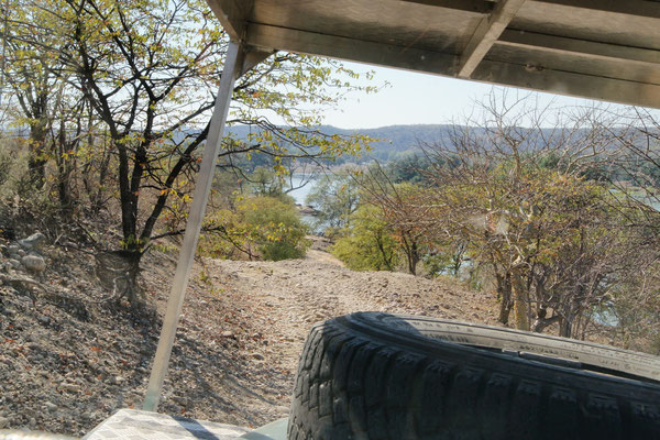
We stayed in Rundu at a campground directly at the Okavango river where we had a good view to Angola.
June 30th 2013: Rundu – Ngepi Camp, Namibia
Driven distance on June 30th 2013: 220km (140 miles)
Driven distance total: 68’220km (42’390 miles)
Drive drive drive. Our next camp laid at the Okavango river, at the place where the river goes down to Botswana into the famous Okavango-Delta. Already shortly before the camp we saw a few hippos in the river. Also at the campground we could spot those animals. There were quite often 2 eyes and little ears appearing from the water. Those animals spend unfortunately most of the day time in the water, because they have very sun sensible skin and can not sweat. During the night they come out of the water to eat grass. Surprisingly we met again the Dutch overlander-couple Rini und Ronald and had a pleasant evening together.
July 1st 2013: Ngepi Camp, Namibia
Driven distance on July 1st 2013: 90km (60 miles)
Driven distance total: 68’310km (42’450 miles)
During the night we heard the hippos grunting and figured out in the morning that they were eating some part of the lawn from the campground :-).
We spent the day with a mini safari near the campground in the small Mahango National Park. Besides some elephants, different horn animals and monkeys, we have also seen again some hippos. Another specialty of the park were the sable antelopes.
Quite quickly we decided in the evening to undertake a 90 minutes boat trip that left from the camp. We actually didn’t see too much on the trip, but at least a crocodile and some hippos. The hippos were always emerging from the water like submarines, stuck their nose shortly into the air to breath and disappeared again afterwards :-).
July 2nd 2013: Ngepi Camp – Namushasha Camp, Namibia
Driven distance on July 2nd 2013: 250km (160 miles)
Driven distance total: 68’560km (42’600 miles)
For a long time we drove through the Babwata National Park. Since this is a through crossing road with a lot of traffic, we didn’t see one animal. After a quite boring day we camped finally at the Kwando River. We had a good view from our campground to the river, where directly in front of our site a hippo was bathing around :-).
July 3rd 2013: Namushasha Camp – Katima Mulilo, Namibia
Driven distance on July 3rd 2013: 150km (90 miles)
Driven distance total: 68’710km (42’690 miles)
And we continued our trip in direction East along the Caprivi-Strip to our final destination in Namibia.